Worcester Viaduct
Worcester has a very impressive viaduct that takes the railway across the valley with the River Severn.
It was originally opened in 1859, though the two-span girder section crossing the river was built in 1905, and replaced three brick arches - or two iron arches according to some sources. I am inclined to believe the latter, as there was a picture, though it was rather indistinct. The viaduct extends some distance into Worcester, and as-built originally comprised 65 arches. Or 68, as other sources state - it may depend on how you are counting it.
Once past Foregate Station, there is an iron bridge over A38; I am not sure if this is original, or another later replacement, but I guess original. The station entrance is on the right in the image.

The railway gently curves to the left over a series of arches, many used for businesses, including a pub called "Arch Rivals".

As you can see, there is still semaphore signaling on the line. Very rare nowadays.

There are two tracks, but it is not double track, but rather two single tracks, with trains running both ways on both tracks. Trains on the north side go to and from the line to Birmingham, trains on the south side go to and from Shrub Hill and the line to London.
At one time there was a siding that ran down to a quay on the riverside, called Butts Siding. It ran along on the north side of the mainline, also on a viaduct as it descended to road level, and part of the viaduct is still there.

Where it crosses Infirmary Walk there is a plate girder bridge, and again this may be a later replacement, put there to give more headroom

There is a distance of about 530 m along the arches, and after about 400 m there is a strange discontinuity. On the east side the arches are skewed to go north, and to the west of it they are angled northwest.
When looked at from the north side, this presents as a very wide pier.

From the south.

The bricks look a different colour, and I wonder if these four arches were rebuilt to better align with the roads at a later time. That said, a 1:2500 map from ca. 1885 suggests the road was already on that alignment by then, but that might be just how it was drawn.
The (possibly) older arches, left above, have a rather unusual design, with the staggered arrangement of bricks that goes up vertical continuing as it curves round the arch. The newer arches are more conventional with concentric circles.
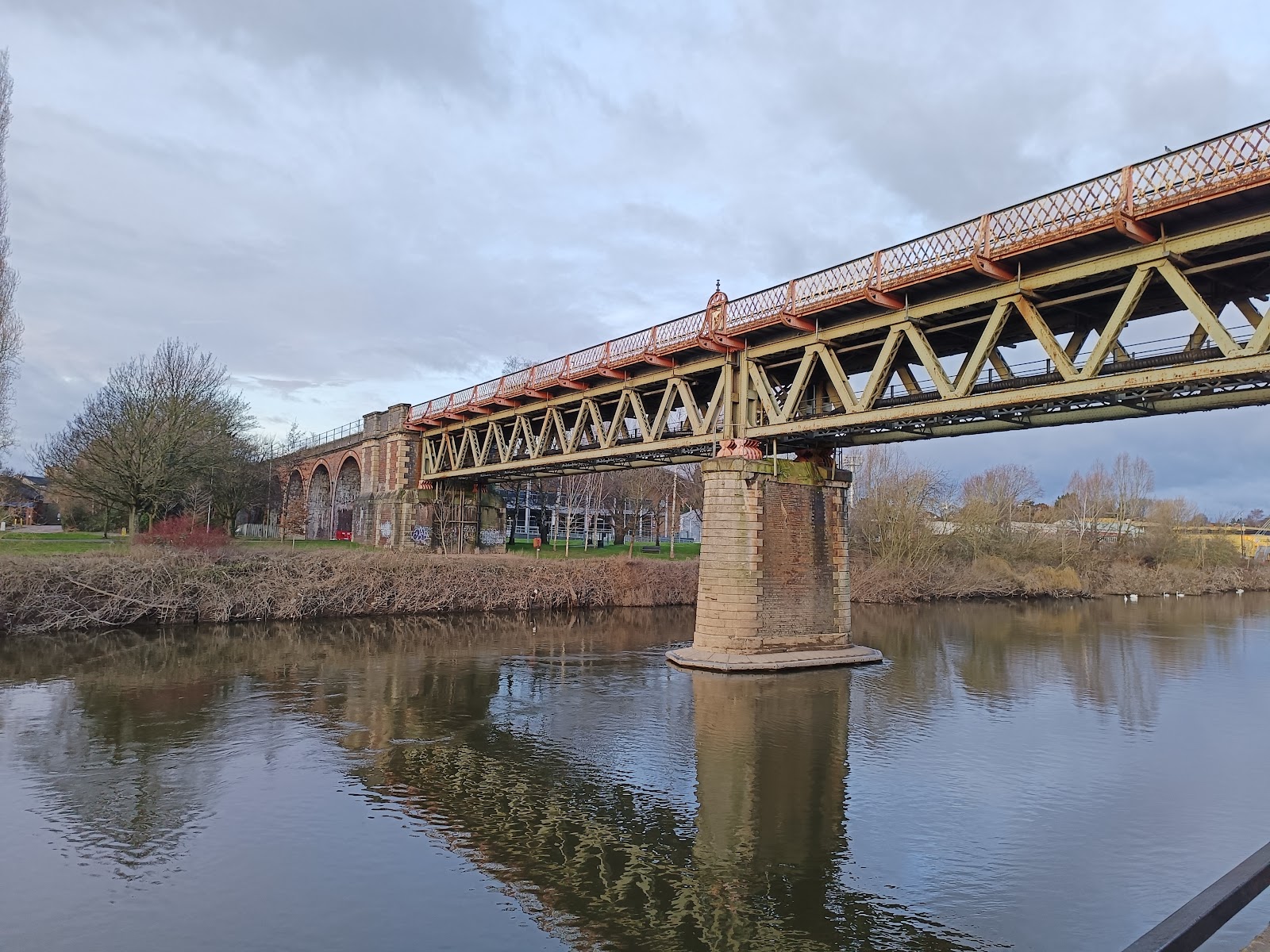
The two spans over the river are iron truss bridges, with the railway over the top.

Each end of the span rests on metal skids on stone blocks, which allows the bridge to move when it expands and contracts in hot and cold weather.

This means the entire weight of the bridge is supported by an area probably smaller than my desk.
As you can see from the above, the bridge is also used to take utility pipes across the river; I guess gas.
There are only about ten arches on the other side of the river, and only half of them are visible. The land rises up more quickly on this side, and it is only 350 m to a level crossing, where the B4206 crosses the line; just beyond that was Henwick station, which closed April 1965.
The Bridge
There is also a bridge to the east of Foregate station that is worth a mention. It takes the railway over the Worcester and Birmingham Canal, and is notable for the circular bit above where the road goes through.

This was probably to save materials, but why not have the arch at the top? I guess there is a limit to how high the vertical bit can be before there is a risk of it bulging and ultimately collapsing.


Comments
Post a Comment